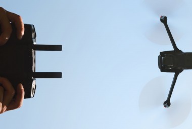
Whether you like it or not, unmanned aerial vehicles (UAVs), aka drones, will be a ubiquitous presence in your life in the very near future.
You may have heard that courier services, such as Amazon Prime Air, aim to 'get packages into customers' hands in 30 minutes or less using small unmanned aerial vehicles'.
Some restaurants have now replaced waiters with drones.
Medical researchers have developed nanoparticle-sized drones which can prevent heart attacks. The drones travel through arteries, seeking out plaques and releasing drugs to reduce the plaques.
Meanwhile, in the entertainment industry, the drone has replaced the selfie stick. The personal drone camera can trail its owner and takes snapshots at the perfect selfie angle.
As you would expect, the emergence of this disruptive technology is accompanied by similar patent trends. This graph shows the exponential increase in patent publications related to UAV over the past decade:
For a piece of technology with such varied fields of application, it is helpful to visualise the patent landscape using tools such as ThemeScape™ maps by Thomson Innovation.
The following ThemeScape™ map visualises UAV-related publications since 2010:
The peaks of the contours, in particular the white areas, indicate large volumes of patent activity. Peaks that are closer together are more related in subject matter.
While the use of UAVs as weapons is widely reported, being so controversial, the map shows higher concentrations in other fields such as spectroscopy and imaging. This would correlate with the finding, as reported in this article, that UAVs are more widely used in agriculture. Spectroscopy is commonly used to monitor crop characteristics; as UAVs can cover large distances almost autonomously, they are ideal for obtaining spectral measurements over large farm areas.
Speed is another characteristic of UAVs, which makes them particularly useful in medical support. Drones can deploy emergency response much faster than ambulance services. Patent US 8,930,044, issued earlier this year to Google, relates to UAVs that navigate to a medical emergency, bringing supplies (eg, medicines, defibrillators, etc) and/or support (eg, video instructions, a direct communication link to medical personnel, etc).
The patent claims a UAV that has two navigation processes for controlling flight. The first navigates the UAV to an approximate target location, via GPS coordinates, for example. The second is a real-time localisation process which kicks in once the UAV is in the approximate target location, to hone in on the target. This may be done, for example, by facial recognition, by detecting a characteristic item of clothing, by requesting input from people nearby, etc.
A third important feature of UAVs is their disposability, or put another way, their ability to access places which are inaccessible or not safely accessible by humans. This leads naturally to their use as weapons, surveillance equipment, and for monitoring in dangerous spaces, eg of pipelines. For example, patent US 8,373,141, assigned to The United States Of America as represented by the Secretary Of The Navy, relates to detecting and measuring radiation fields such as those caused by nuclear power plant leaks, bombs, or for inspecting nuclear powered ships, without direct human exposure.
The method described measures radiation using dosimeter chips strewn over the suspected area. Dosimeters change colour when exposed to ionizing radiation. By taking an aerial photograph of the dosimeter chips using a UAV, and comparing the colour against calibration data, the extent, as well as the amount of radiation, can be quantified without requiring direct human contact.
While there are obvious privacy and safety issues that need to be ironed out, drones will undoubtedly be disrupting technology - and our lives - as we know it. Keep your eyes peeled.
An edited version of this article first appeared on the Idealog website on 4 March 2015.


